
- Visualizing the geographic configuration of a multi-region cluster on a world map.
- Viewing real-time cluster metrics.
- Drilling down to individual nodes for monitoring health and performance.
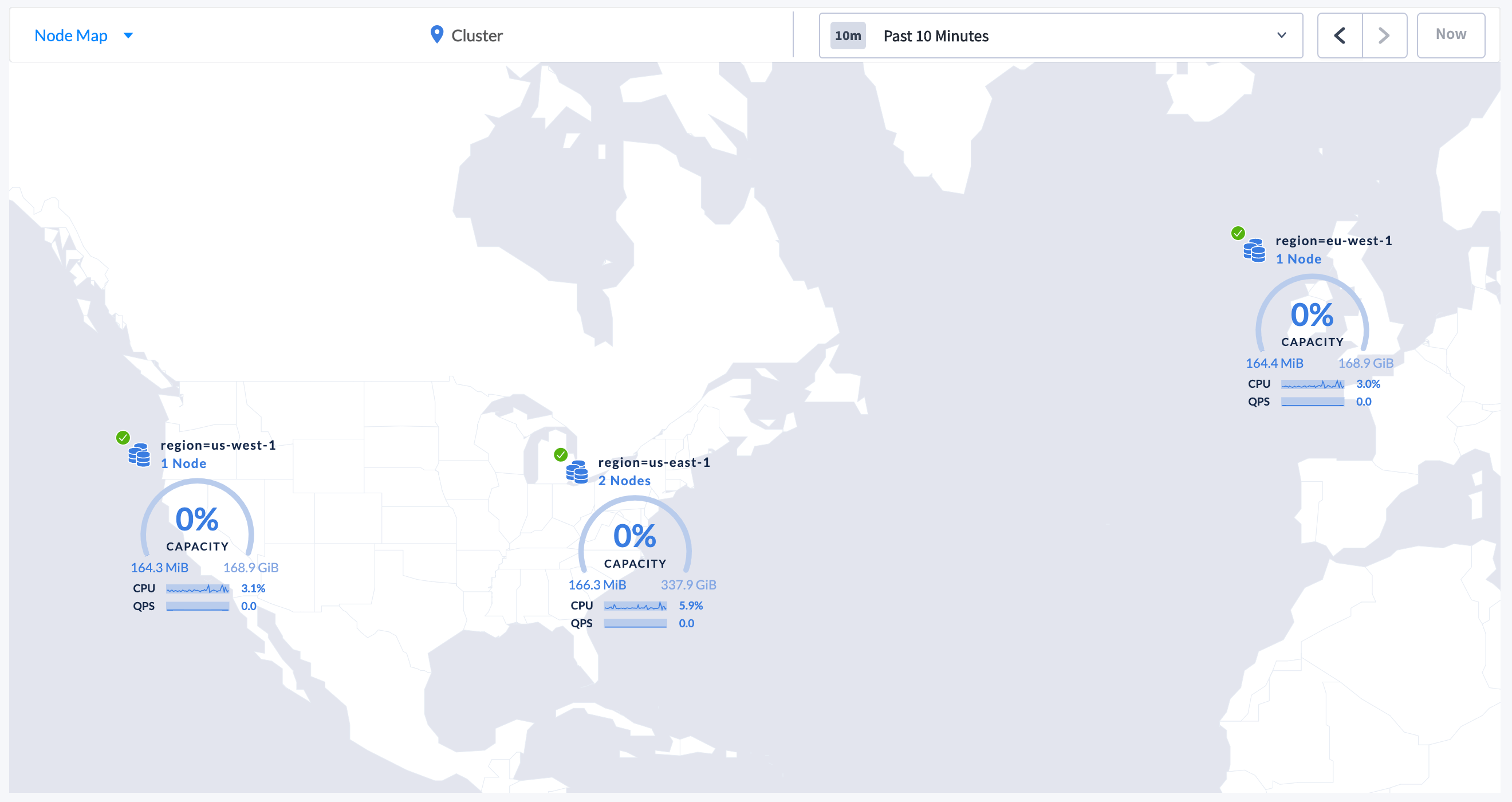
Set up and enable the Node Map
To enable the Node Map, you need to start the cluster with the correct flags and assign the latitude and longitude for each locality.The Node Map will not be displayed until all nodes are started with the correct
--locality flags and all localities are assigned the corresponding latitude and longitude.Step 1. Start the nodes with the correct --locality flags
To start a new cluster with the correct --locality flags:
-
Start Node 1:
-
Start Node 2:
-
Start Node 3:
-
Start Node 4:
-
Use the command to perform a one-time initialization of the cluster:
- .
-
If the node list displays, click the selector
 and select Node Map.
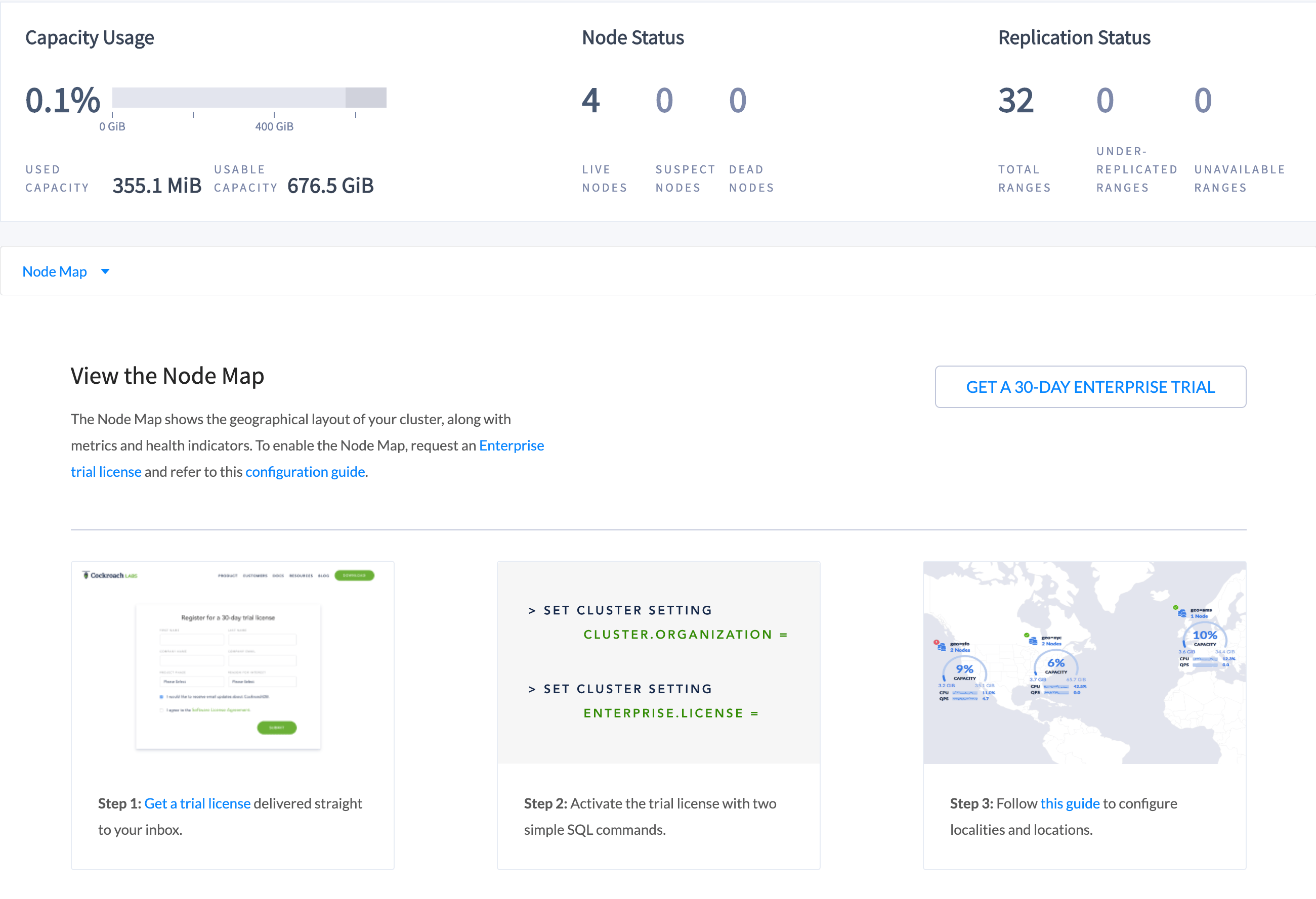
Step 2. Set the Enterprise license and refresh the DB Console
The Node Map should now be displaying the highest-level localities you defined: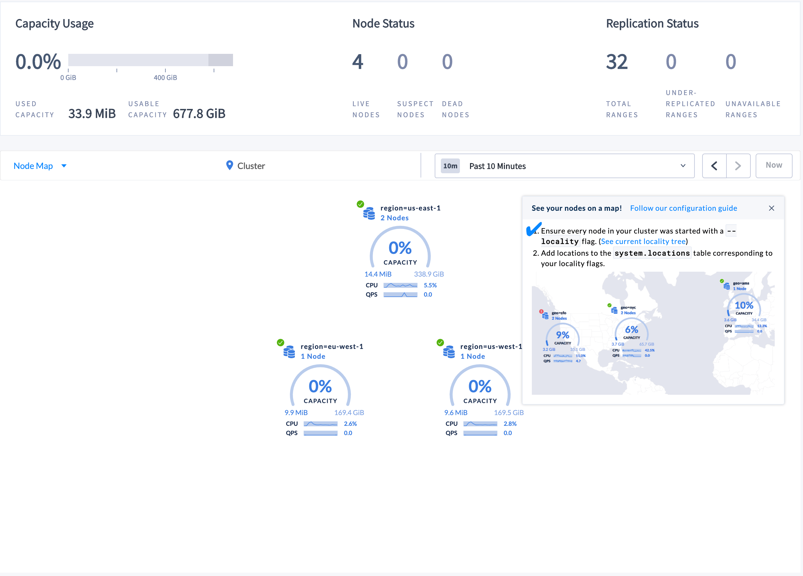
To be displayed on the world map, localities must be assigned a corresponding latitude and longitude.
Step 3. Set the latitudes and longitudes for the localities
-
Launch the built-in SQL client:
-
Insert the approximate latitude and longitude of each region into the
system.locationstable:
Step 4. Refresh the Node Map
Refresh the DB Console to see the updated Node Map: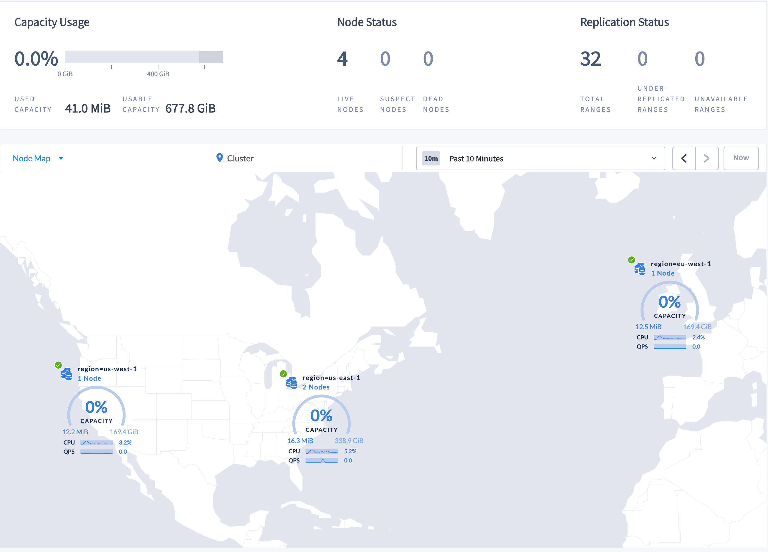
Step 5. Navigate the Node Map
To navigate to Node 2, which is in datacenterus-east-1a in the us-east-1 region:
-
Click the map component marked as region=us-east-1 on the Node Map. The for the datacenter is displayed.
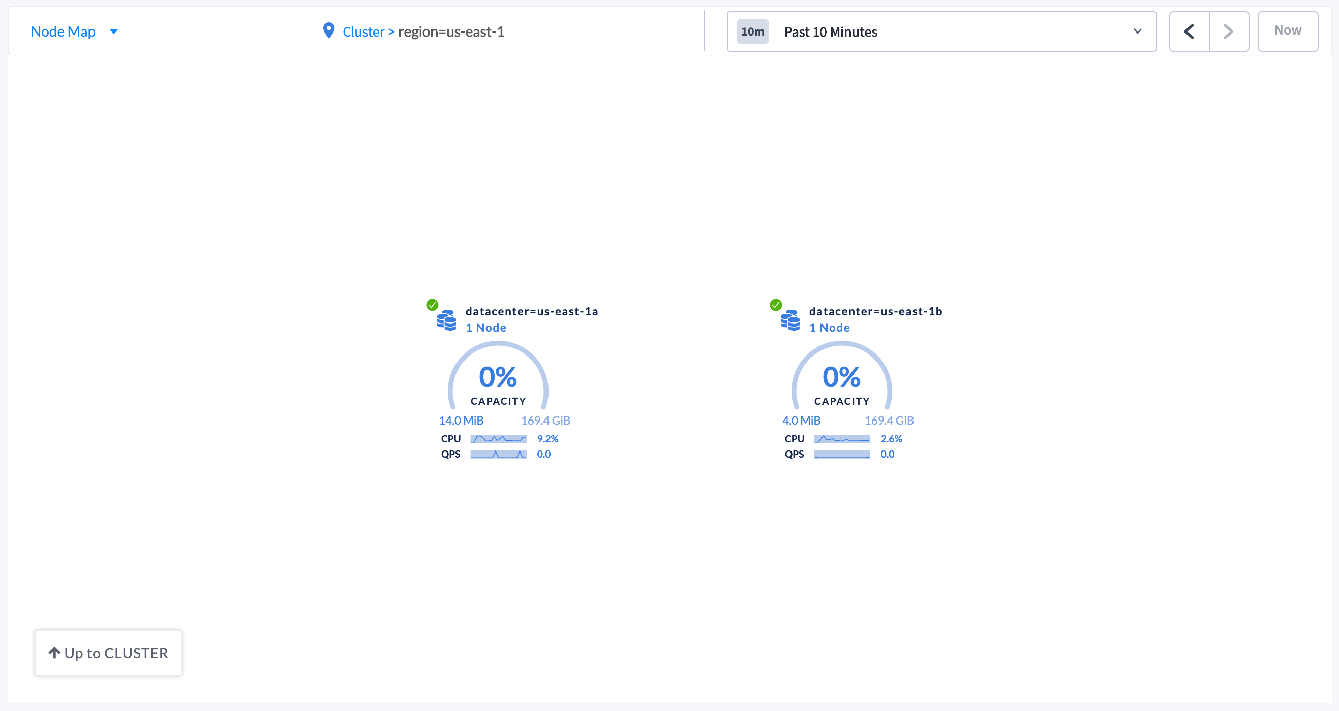
-
Click the datacenter component marked as datacenter=us-east-1a. The individual are displayed.
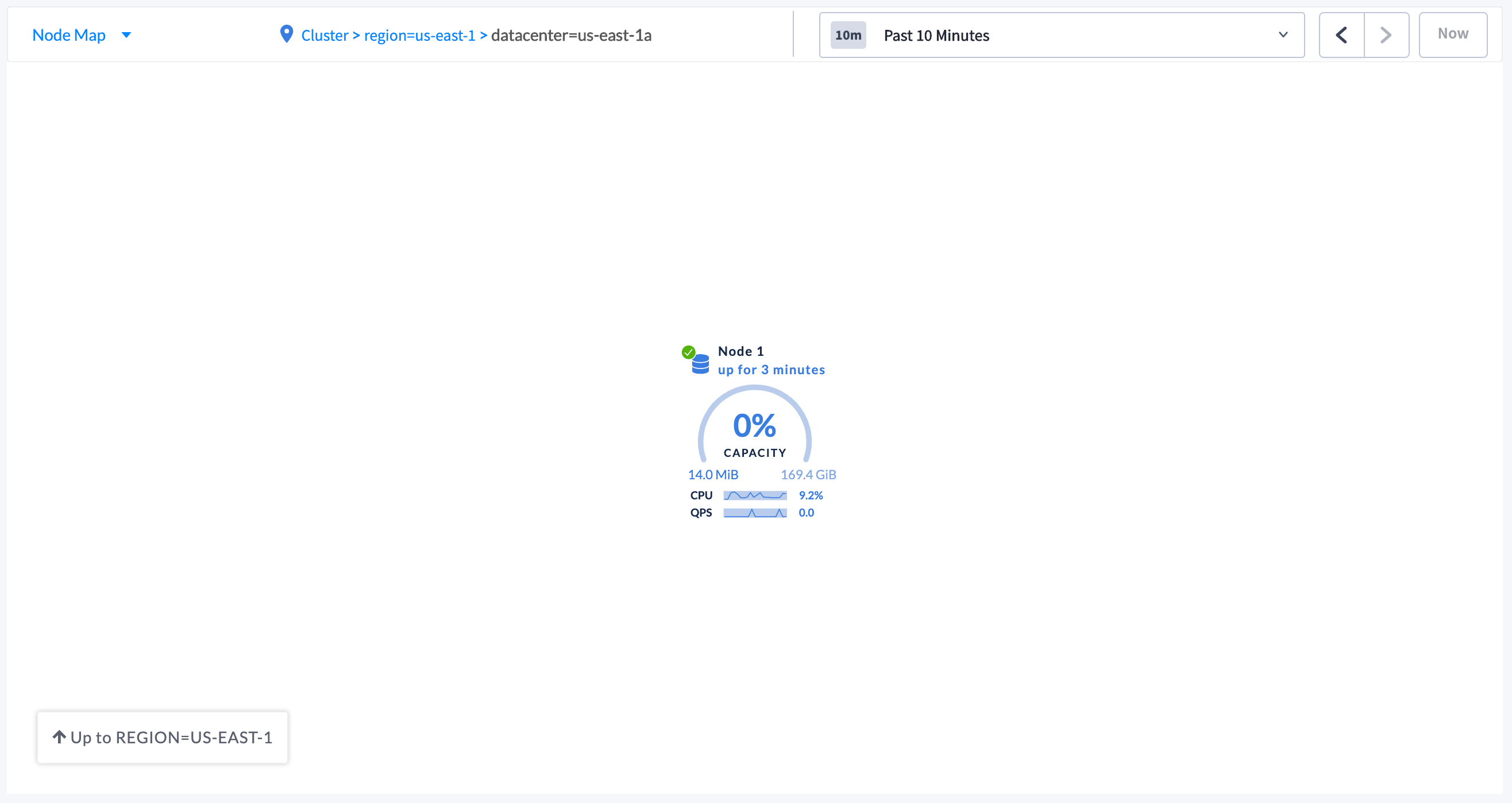
- To navigate back to the cluster view, either click Cluster in the breadcrumb trail at the top of the Node Map, or click Up to REGION=US-EAST-1 and then click Up to CLUSTER in the lower left-hand side of the Node Map.
Troubleshoot the Node Map
Node Map not displayed
- All nodes in the cluster must be assigned .
- Localities must be assigned a corresponding latitude and longitude.
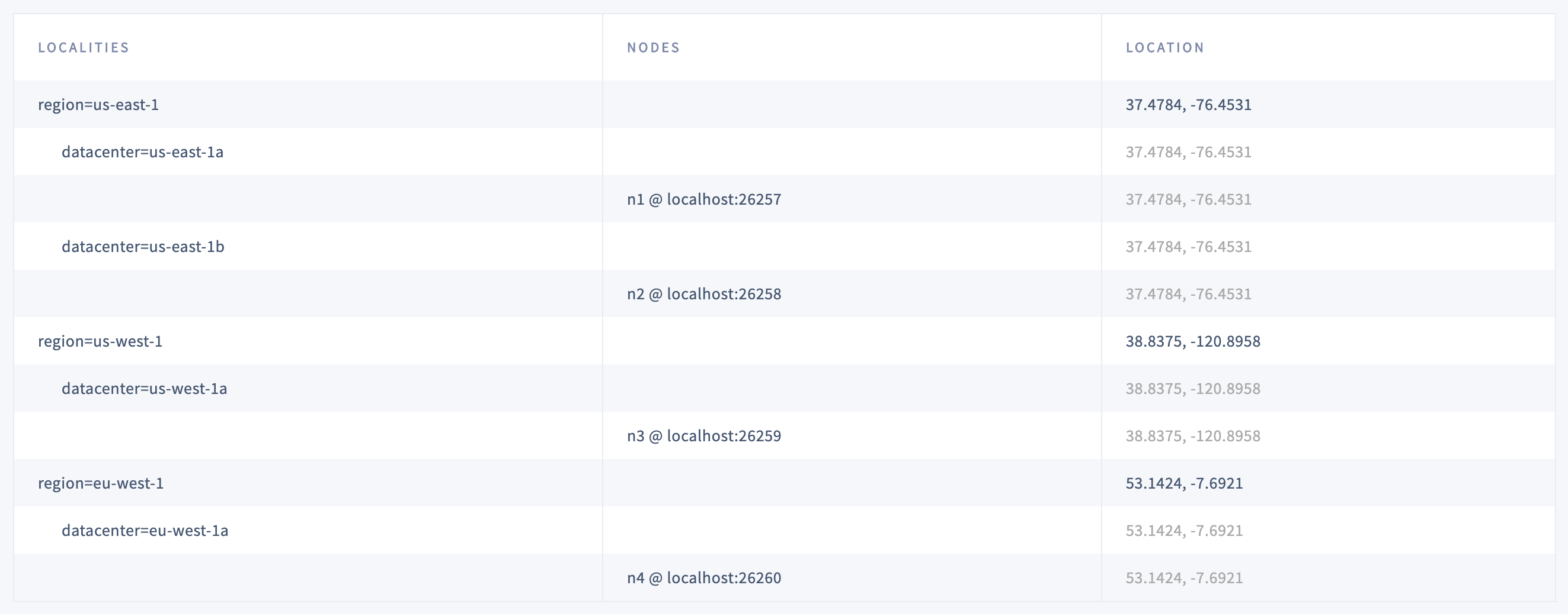
- Localities configuration that you set up while starting the nodes with the
--localityflags. - Nodes corresponding to each locality.
- Latitude and longitude coordinates for each locality.